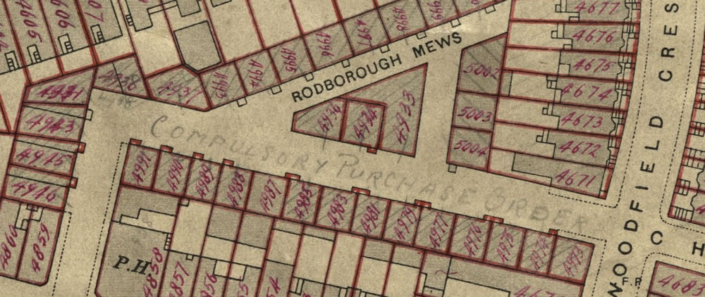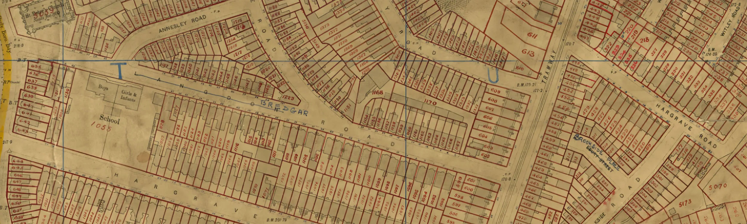
The 1910 Lloyd George Domesday Survey is a unique combination of maps and residential data originally held by The National Archives. Researchers can precisely locate their ancestor's house on large scale (up-to 5 feet to the mile!) hand annotated maps.

Searching a modern map for historic addresses is problematic as areas could have been destroyed in the Blitz or redeveloped in the intervening years, changing sites out of all resemblance from what had stood there before. Many lanes and roads have been extinguished to build estates and office blocks. Streets may have been renumbered, redirected, while others have been shortened with part of the road having been built over. All this means that searching for where an ancestor lived by using modern maps can be frustrating when they fail to pinpoint where the old properties had once been.
Our Lloyd George Domesday records link individual properties to extremely detailed ordnance survey maps which are coupled with the accompanying books that will also provide researchers with basic information relative to the valuation of each property, including the valuation assessment number, map reference, owner, occupier, situation, description and extent. It also enables family historians and those doing house histories to locate a specific house using an address that has previously been found in a census or street directory. Fully searchable by name, county, parish and street.
What detail can I see for properties?
With a single click family historians and house history researchers are then able to see the property located with a pin on an up to five feet to a mile Ordnance Survey map. The historic map reveals each and every house annotated by the surveyors with a reference number to link the property to the details in the accompanying books. As the original map was part of a government tax gathering exercise, the location of an ancestor's house is going to be very accurately recorded and therefore must have been in existence at the time.
- The Lloyd George Domesday Survey identifies individual properties on extremely detailed 1910-1915 maps.
- Researchers can view images of original Field Books often with a detailed description of the property.
- Users may locate an address found in a census or street directory down to a specific house on the map.
- The records are fully searchable by name, parish and street.
- The georeferenced OS maps are a layer over a modern street map underlay so that changing the base map displayed allows researchers to understand what the area looks like today.
The maps zoom right in to show the individual properties as they existed in 1910 and the records can be searched using the Master Search or by clicking on the pins displayed on our powerful Map Explorer. This tool can even be used on your mobile device or tablet, guiding you down the same streets that your ancestors lived on.
What was my ancestor's home like in the 1910s?
These Lloyd George Domesday Survey records are an amazing resource for the family historian as they allow researchers to read a description of land and properties as they existed in the period just before and into the first few years of the First World War. The records are held by The National Archives at Kew and in partnership with TheGenealogist the IR58 and IR121 records are being digitised and released online.