Unique Resources
1921 Census Substitute
We created the 1921 Census Substitute in 2018 when the 1921 Census was still some years away from public release. This resource covers a large number of county directories which had been transcribed to produce a searchable resource encompassing a period not served by a published census at that time.'
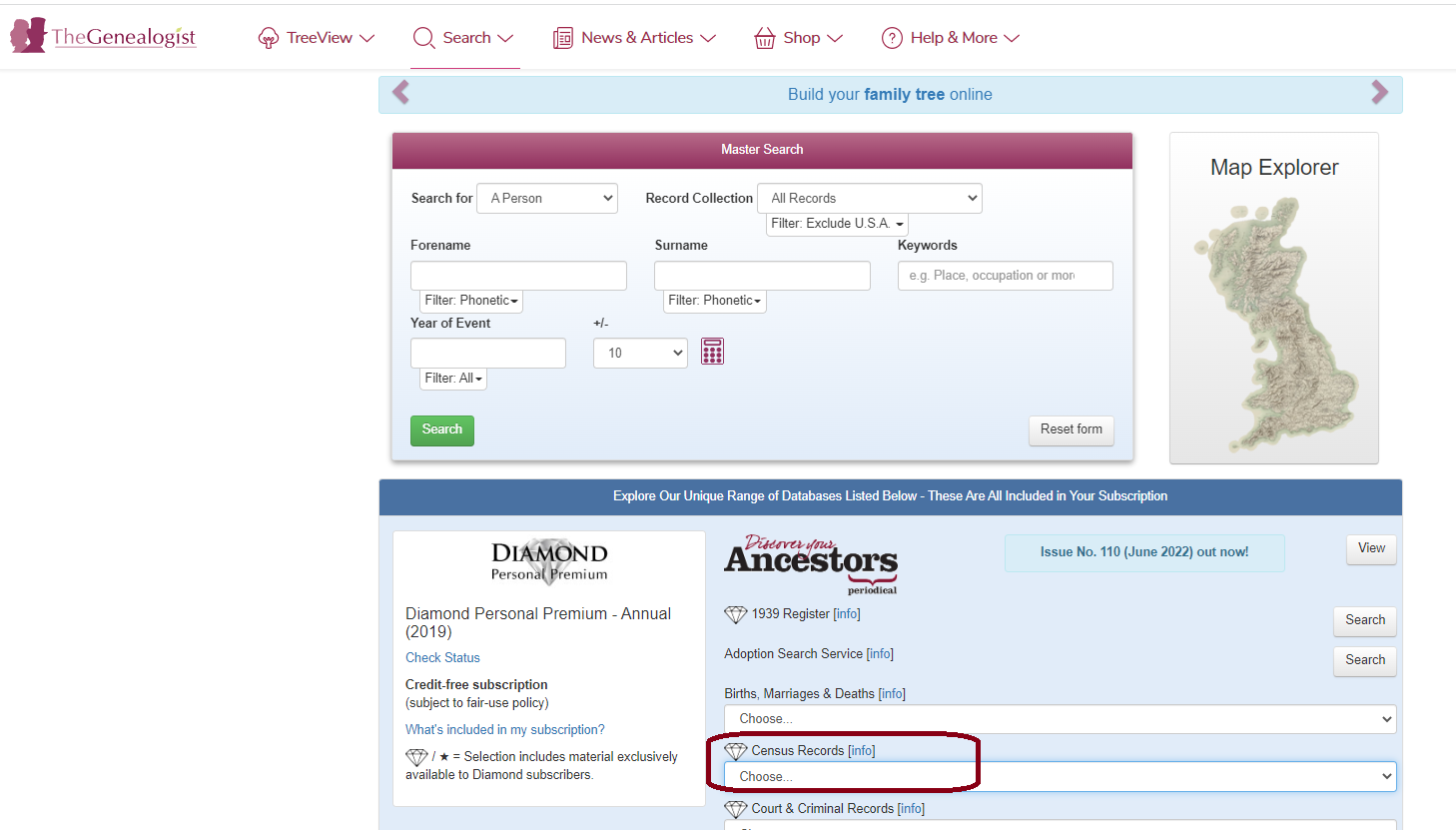
To access the 1921 Census substitute you just need to click 'Census Records' from the Advanced Search databases underneath the Master Search,
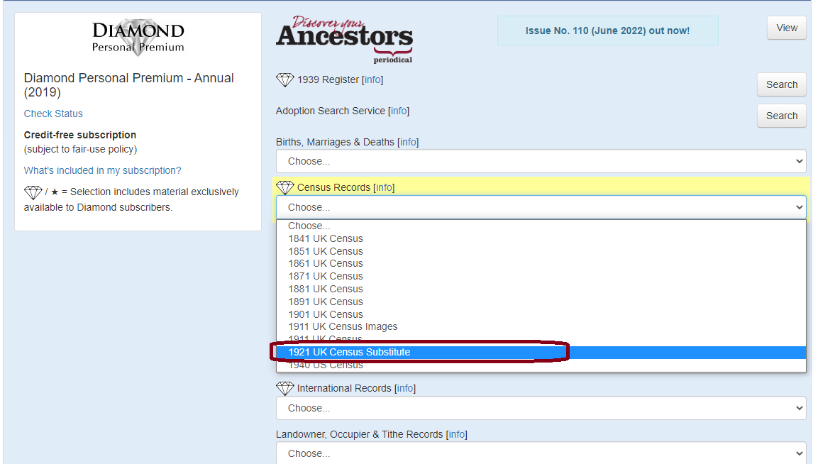
From the drop down menu you can then select '1921 Census Substitute’
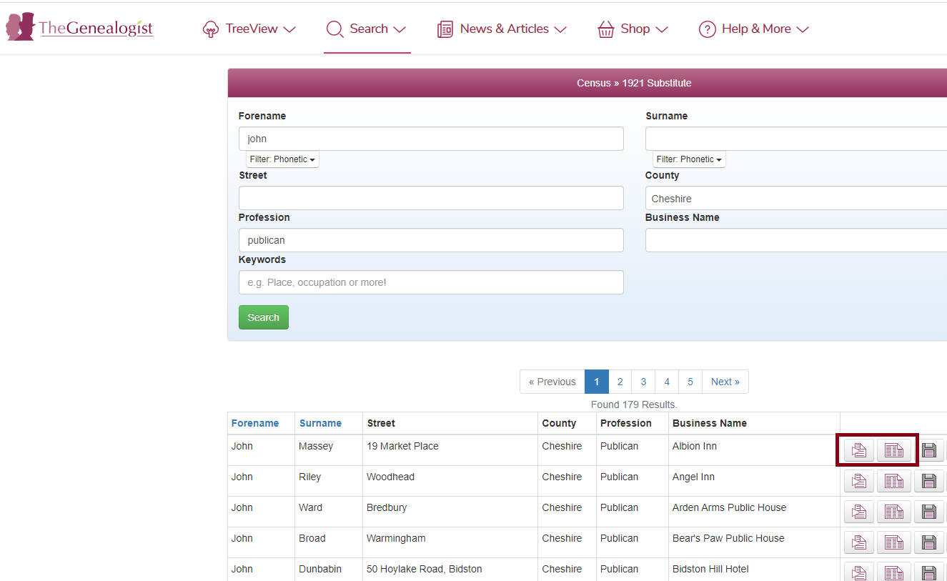
This will then display the following search screen;
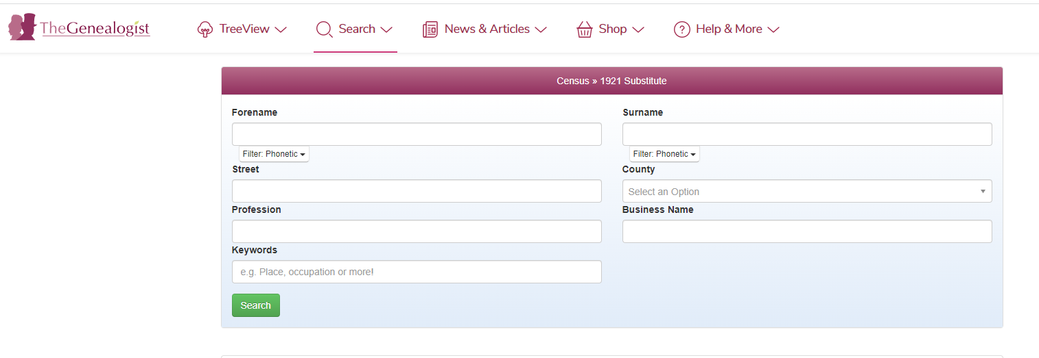
As the records are fully transcribed, these searchable records allow you to search by forename, surname and profession as well as by street, county and business name if you know it.
You will then be able to view the transcript by clicking on the first icon displayed next to the entry and then the original page of the directory by clicking on the second icon as shown below, the third floppy disc icon saves the data to your Research Log or tree in Treeview our online tree builder ;
When clicking on the second icon for the original page of the directory, the entry is highlighted on the page as displayed below;

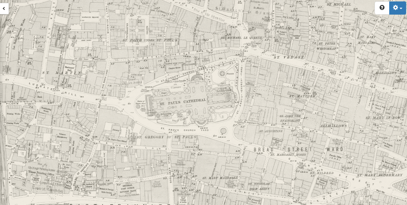
Charles Booth
Our innovative Map Explorer, which allows researchers to trace an ancestor's property and then view the changing environment over time, now boasts another powerful new feature. While previously researchers were able to view the georeferenced Lloyd George Domesday Survey Data Layer of maps and also see the sites of UK War Memorials, cemeteries and churchyards from across the country, TheGenealogist has now added the fascinating Booth Poverty Maps of London 1898-1899 to this useful resource.
- Use the new Charles Booth Maps to reveal London streets classified by income and class
- Research neighbourhoods where different classes of people lived close to each other
- Use the opacity slider to view various modern day maps as a base layer to see the area today
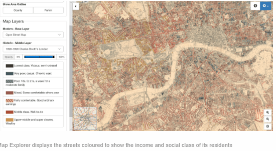
There were seven classifications detailed on Booth Maps ranging from the lowest to the wealthy. The streets were coloured as follows:
- Black - 'Lowest classes. Vicious, semi-criminal.'
- Dark Blue - 'Very poor, casual. Chronic want.'
- Light Blue - 'Poor. 18s to 21s a week for a moderate family.'
- Purple - 'Mixed. Some comfortable, others poor.'
- Pink - 'Fairly comfortable. Good ordinary earnings.'
- Red - 'Middle class. Well to do.'
- Yellow - 'Upper-middle and upper classes. Wealthy.'
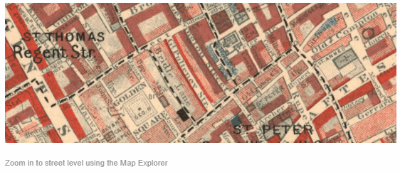
Our powerful Map Explorer has been developed to view these georeferenced historic maps overlaid on top of modern background maps including those from Ordnance Survey and Bing Street maps, as well as a satellite view. With the Map Explorer you can search for an ancestor's property, discovering its site, even if the road has changed or is no longer there.
To access this resource:
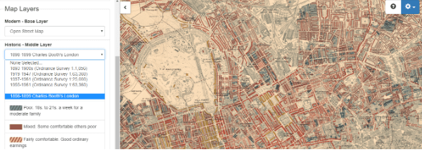
Click on 'Search' and choose 'Map Explorer' from the drop down menu:

Enter London in the ‘Search a place’ field then choose ‘1898-1899 Charles Booth’s London’ from the drop down menu under Historic – Middle Layer :
Use your mouse to zoom in/out and navigate around the map or by pinching with two fingers if using a touch screen.
Lloyd George
Researchers often have difficulty using modern maps to find where ancestors lived as road names changed over time, the Blitz saw areas bombed to destruction, developers changed sites out of all resemblance from what had stood there before and lanes and roads were extinguished to build housing estates and office blocks.
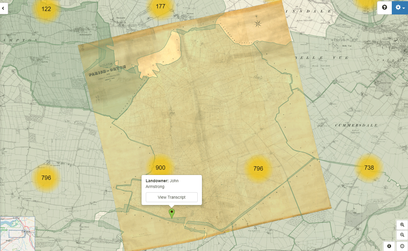
The 1910 Lloyd George Domesday survey combines a unique combination of maps and residential data, held by the National Archives, which enables researchers to precisely locate their ancestor’s house on large scale hand annotated maps of London.
As these records are linked to the maps from this period this means that you have the ability to find the streets as they existed when the survey was carried out and often pinpoint where the old properties had once been.
Individual properties are linked to extremely detailed ordnance survey maps used in 1910 which are coupled with the accompanying books that will also provide researchers with basic information relative to the valuation of each property, including the valuation assessment number, map reference, owner, occupier, situation, description and extent. It also enables family historians and those doing house histories to locate a specific house using an address that has previously been found in a census or in a street directory.
- Links individual properties to extremely detailed ordnance survey maps used in 1910
- Shows the original field book often giving a detailed description of the property
- Pinpoint an address found in a census or street directory down to a specific house on the Map
- Fully searchable by name, county, parish and street
- Zoom into the maps to show individual properties as they existed in 1910-1915
- See the outlines of their houses of their houses on large scale maps from the time
- Fade between historic and modern maps to see how the environment has changed
- Check details of properties in the neighbourhood by clicking the red pins
This is a vast ongoing project involving the digitisation of over 94,500 Field Books, each having hundreds of pages and linking them to large scale IR121 annotated OS maps which are now viewable with our powerful Map Explorer tool.
To access this resource:
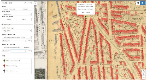
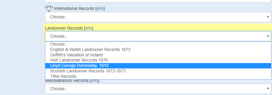
The best way to search these records is to use our advanced search facility; you can access this by clicking the ‘Search’ tab along the top of the website and choose 'Find Records'. Scroll down the page below the Master Search for a list of databases, and choose ‘Lloyd George Domesday 1910’ from the & ‘Landowner Records’ dropdown menu:
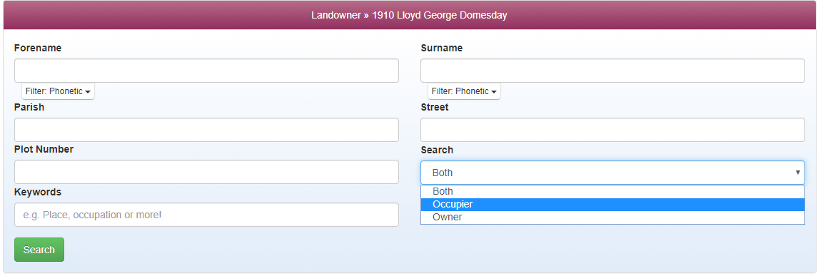
Here you will be able to search using a variety of search criteria. You can also search by Parish and Owner/ Occupier by using the drop down menus:
Map Explorer
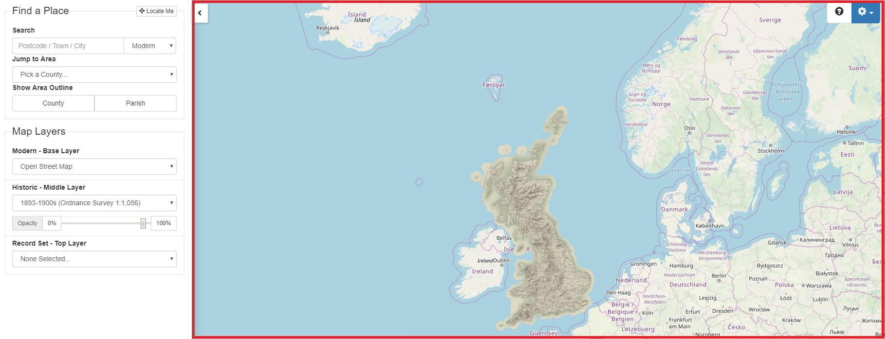
Our innovative Map Explorer adds rich functionality to our growing collection of map-based records.This powerful tool has been developed with georeferenced historic maps layered over several modern background maps including Ordnance Survey, Open Street Map, Satellite and hybrid/satellite view.
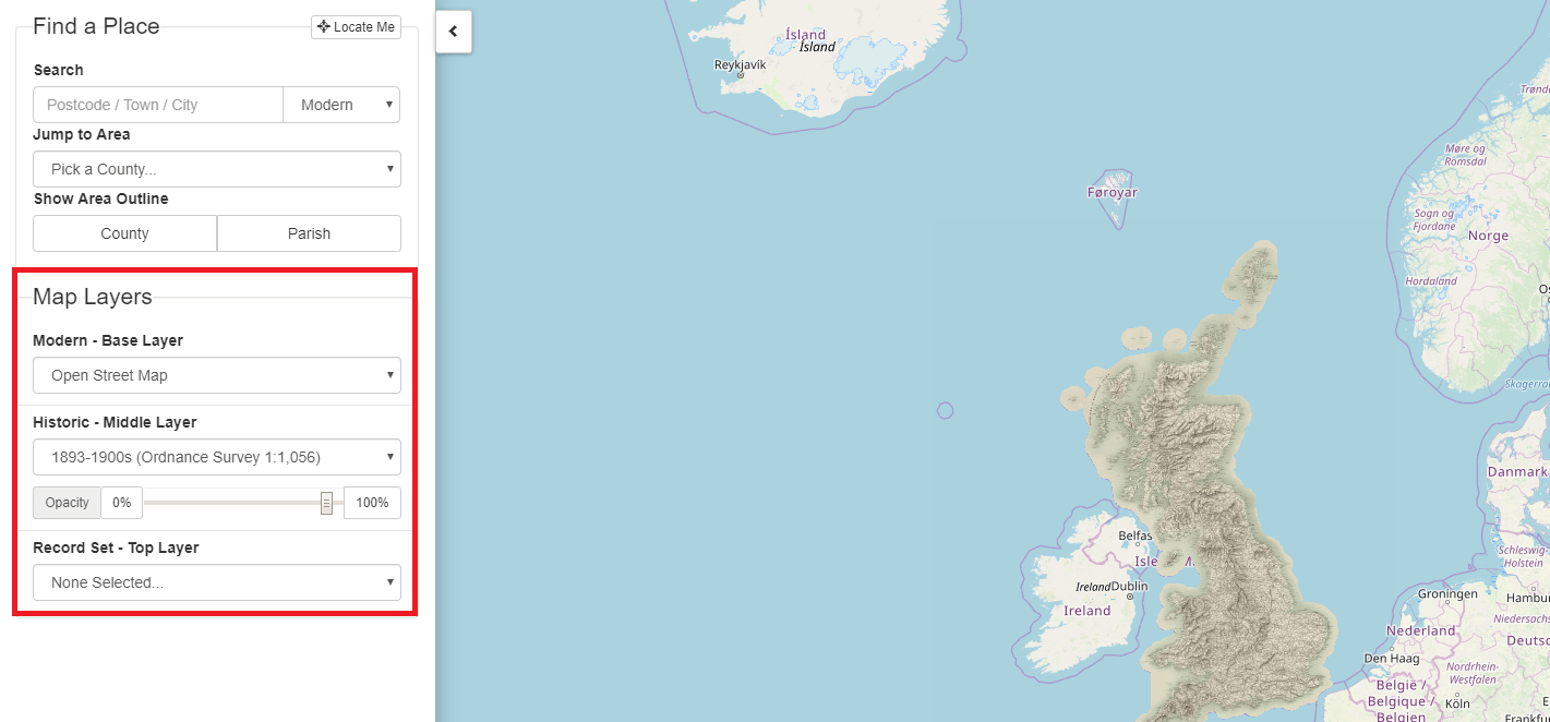
Researchers can view different maps on top of each other like sheets of paper. Maps have been divided up into 3 types of layers so you can change the transparency of a layer to view the layers below. This allows you to see how an area has changed over time.
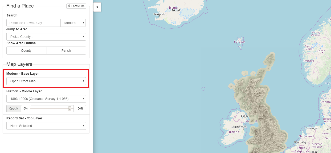
The Base Layer
This is the modern layer, which can be used to select a modern OS Map, Open Street Map or a Satellite Image.
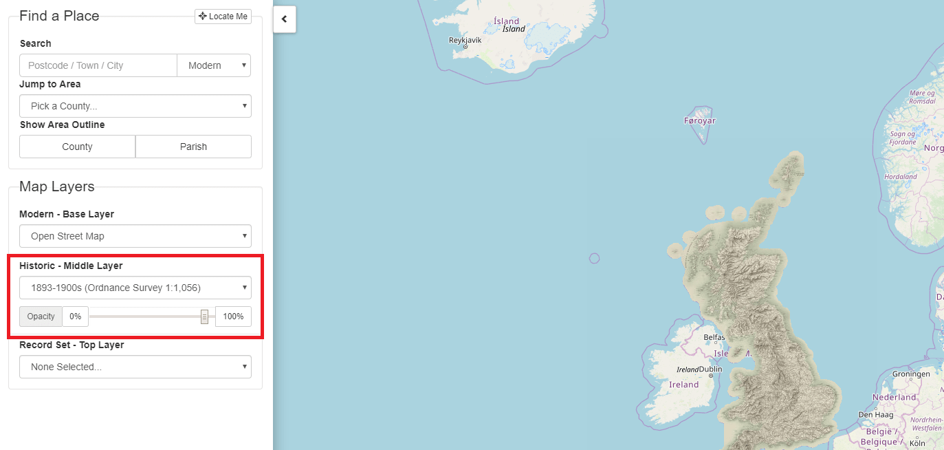
The Historic Layer
The historic layer can be used to select a range of OS maps from the 1890s to the 1960s
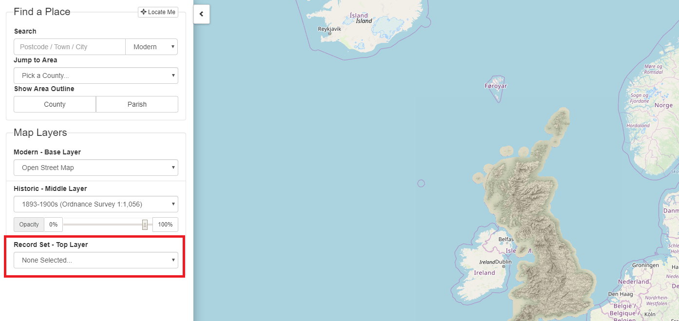
The Record Set Layer
The record set layer provides access to map record sets such as Lloyd George Domesday Survey records and the National Tithe Map record collection.
This layer also has the ability to show ‘Pins’, these are map markers that link directly to the records so you can see who was living at a particular property. This is currently for the Lloyd George Domesday survey records, the National Tithe Map Record Collection, War Memorials and Headstone records. Further record sets will be added to this layer in the future.
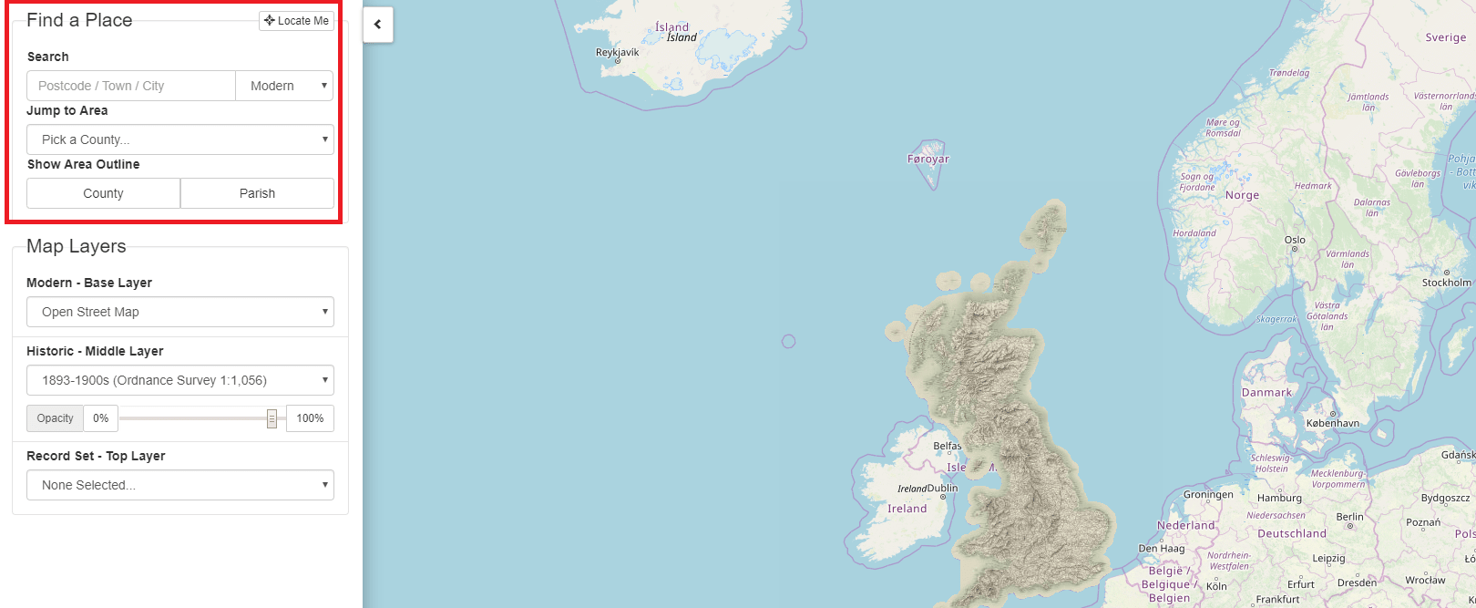
Use the ‘Find a Place’ controls to navigate quickly to a place e.g. search for an address, jump to a county or ‘Locate Me’ (if your device supports it). You can also turn on County and Parish outlines:
Map layers are like sheets of paper; they stack on top of each other and display different types of map:
The base layer can be changed between a number of modern maps, allowing you to find a current feature or see how the area has changed:
The middle layer can be one of a number of historic maps from the 1800s and 1900s. You can change the opacity to fade it out and view the modern layer below:
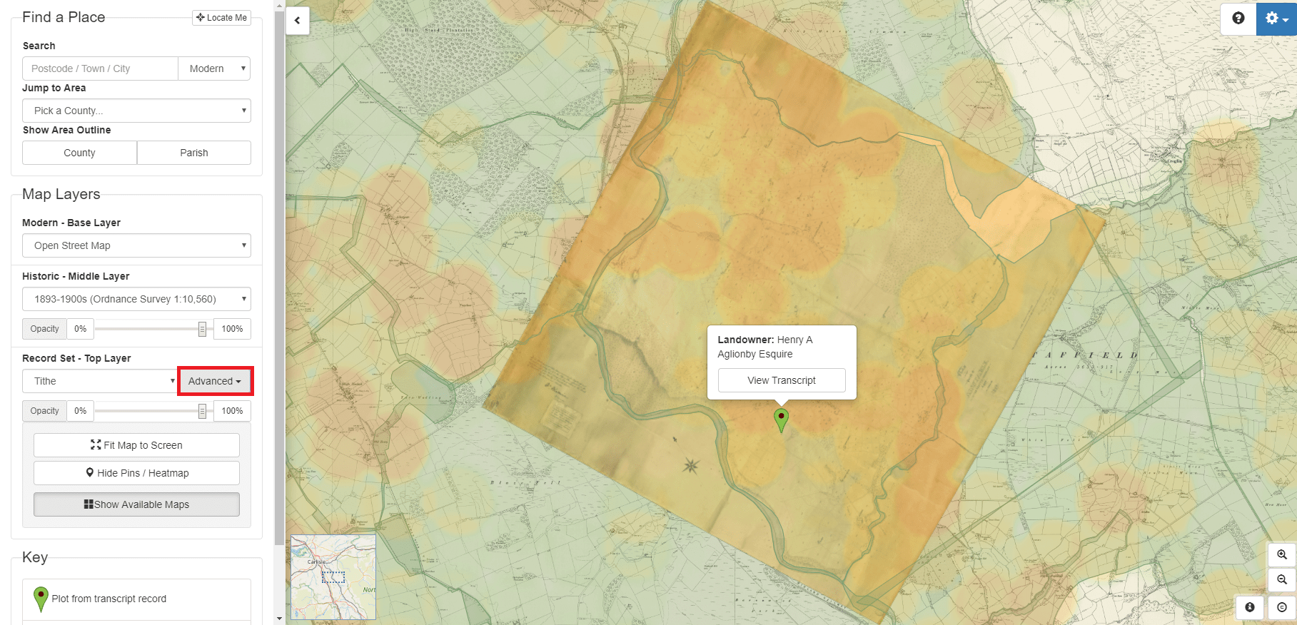
The top layer can show the record set you are exploring. This can include an image of the map a record is on and associated pins showing the position of records.
Again you can change the opacity to fade out the layer. The ‘Advanced’ button provides additional options relating to the current record set, such as showing available map images or the shapes of historic areas:
The right hand side shows the map, move around by dragging, zoom by scrolling or pinching with two fingers if using a touch screen:
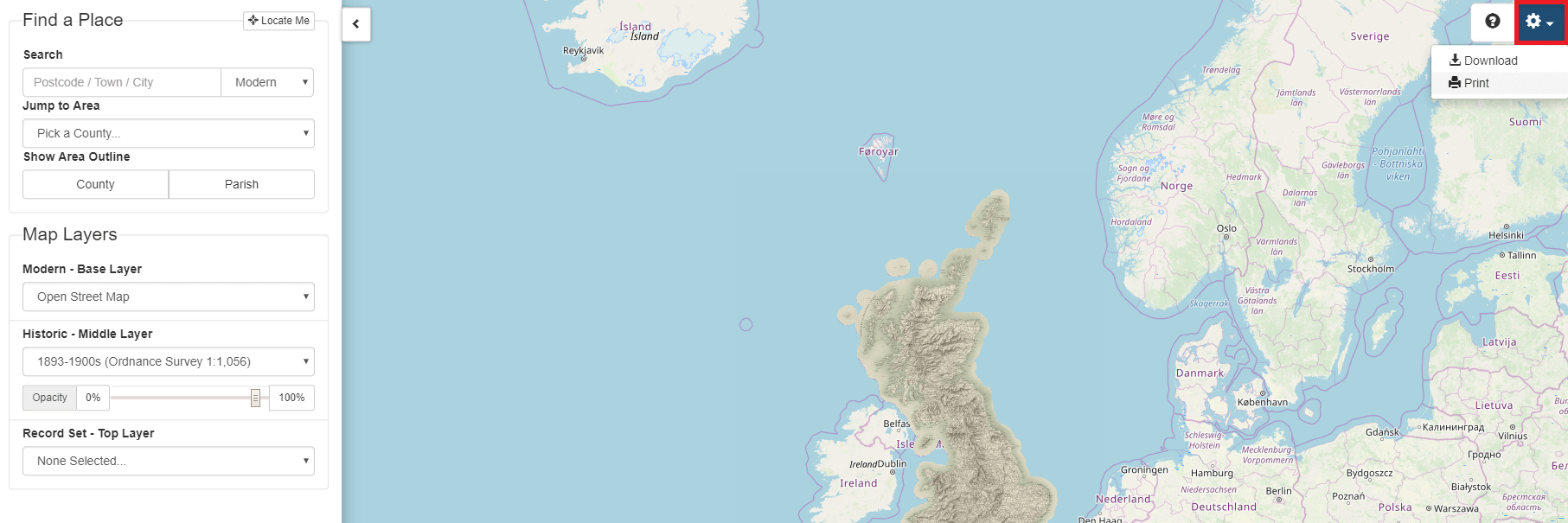
You can save the currently displayed map as an image or print by using the menu options via the settings button:
Or view a tour of the feature by clicking on the question mark:
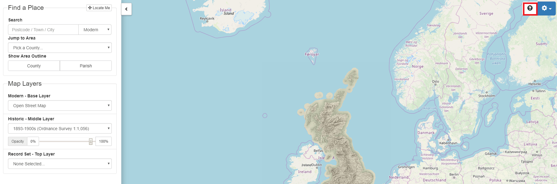
You can also see a short video introducing this innovative new tool at:
https://www.thegenealogist.co.uk/maps
Not only can our Map Explorer™ help researchers find an ancestor's property and watch the landscape change over time it has been enhanced by the addition of georeferenced Tithe Maps
We have also made it possible to find thousands of historic pictures pinpointed on a map, so you can travel the streets, comparing views of past and present.
Open up an image and you will be able to see its location as well as from what point of view the photograph was taken. That's not all, as underneath the historical image, is a modern map and street view (where available) so that you can now compare the picture from the past with how the area looks today.
Tithe Records
Tithe records are an extremely interesting and useful resource for adding detail to your family tree or if you are just interested in your house history. They can usually tell you the name of the land owner, occupier and what land was being used for, letting you know if your ancestor was a wheat farmer or if they specialised in some other arable crops or kept a smallholding to subsidise their income.
A Tithe historically was where you paid a tenth of your produce to the local church. After the dissolution of the monasteries some of their Tithable land was redistributed to local landowners who gained the rights to the Tithe rent payments.
Created by the government, in a period from 1837 to the early 1850s, Tithe records were the result of a very comprehensive survey into the usage, ownership and occupation of land in England and Wales. This is great for genealogists as it is a nationwide survey, years before the first usable census and includes 11,830 tithe districts which were apportioned and mapped. 10,871 in England and 959 in Wales
The records are linked to illustrated maps showing plots of land as well as giving you a detailed picture of the parish.
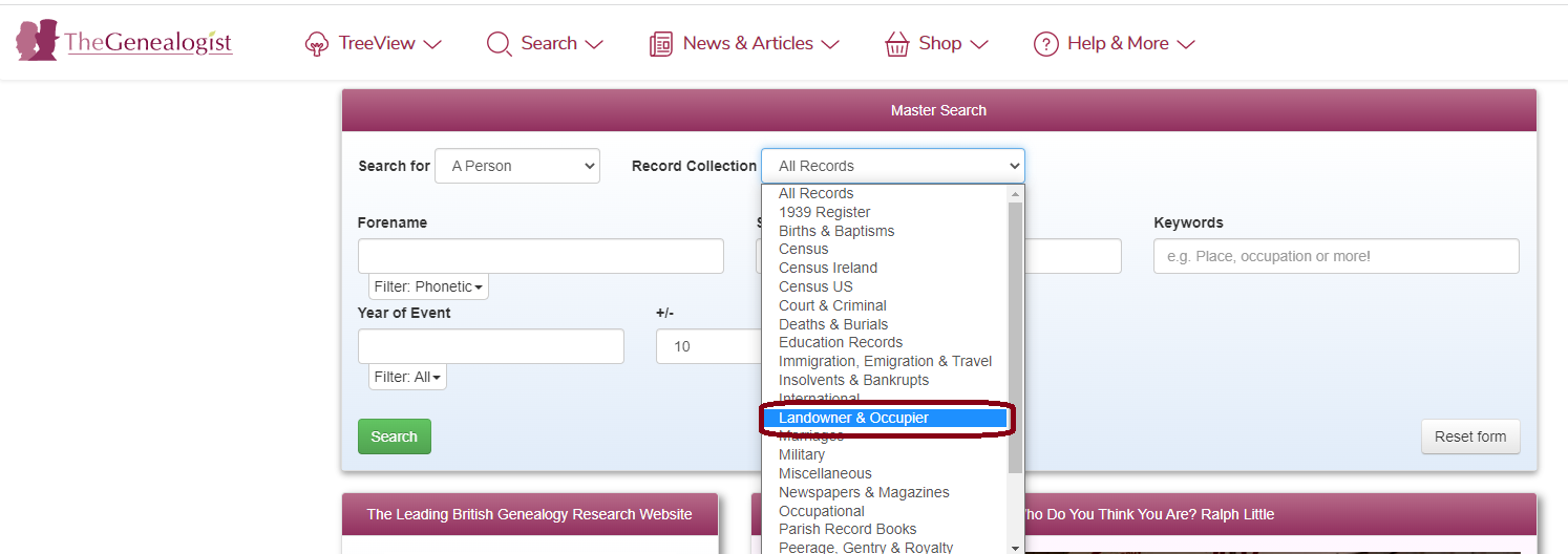
To access these records for a quick search you can either use the Master Search and select ‘Landowner and Occupier’ from the Records Collection List and search for an individual such as the landowners name/occupier if you know it.
Or, perhaps the best way to search our Tithe records is to use our advanced search facility which you can access by clicking on the ‘Search’ tab and choose 'Find Records' from the drop down menu then scroll down the page below the Master Search to select the ‘Search’ tab adjacent to ‘Tithe Records’ visible from the 'Landowner Records' dropdown menu.
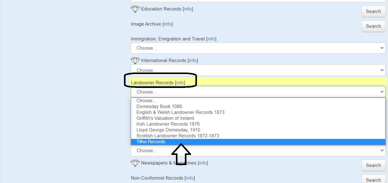
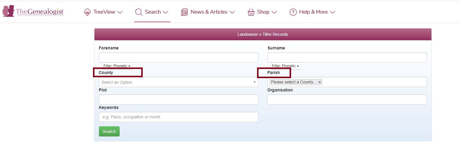
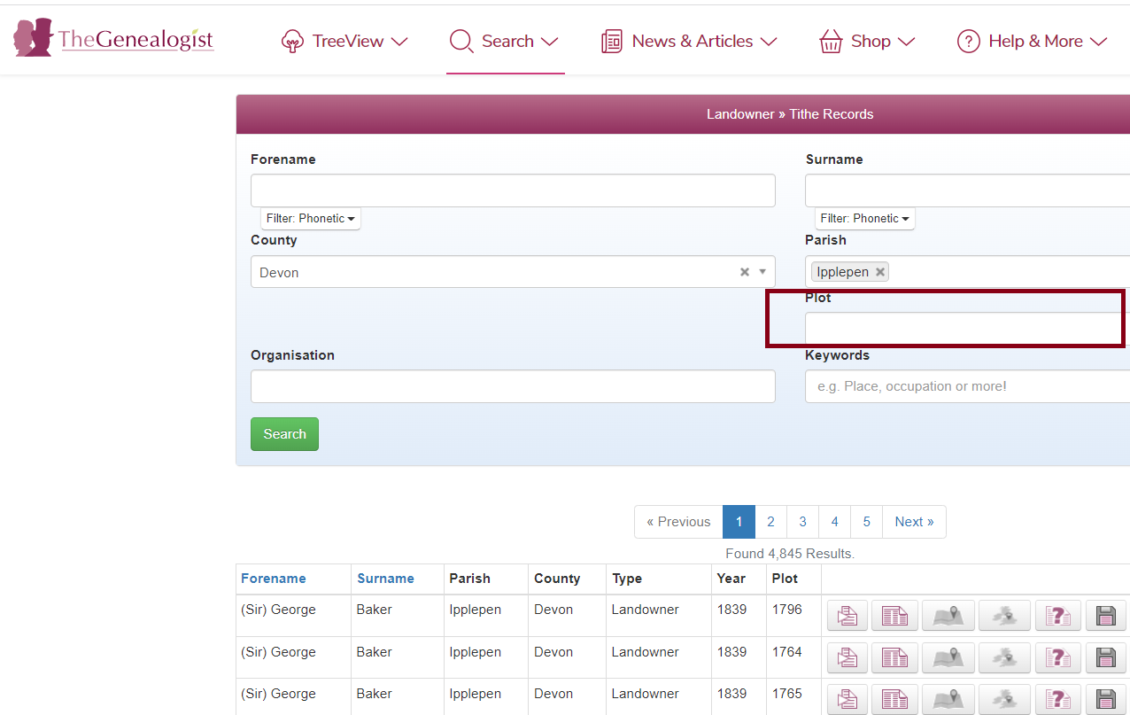
Here you will be able to search the Tithe maps using a variety of search criteria. You can search by County and Parish alone with no need to enter a forename or surname by using the drop down menus or even enter a plot number if you know it.
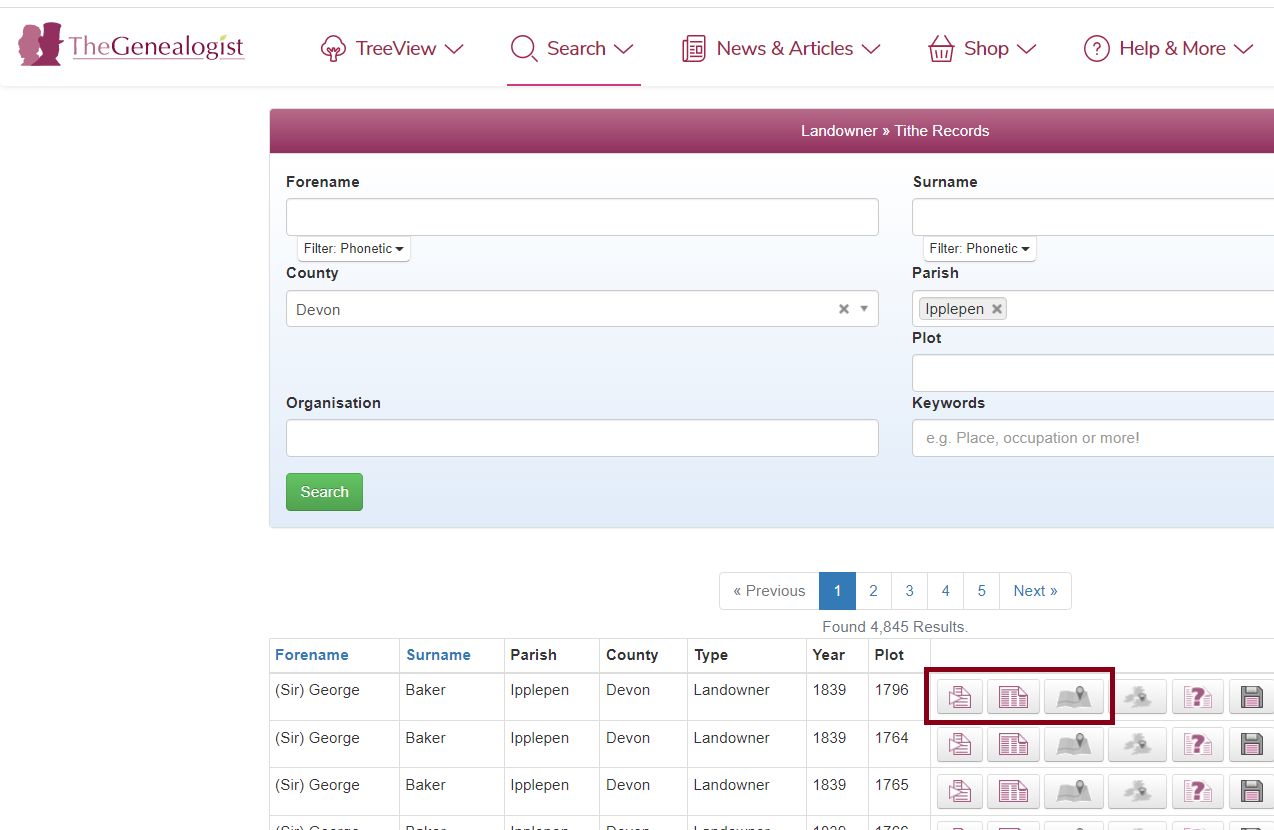
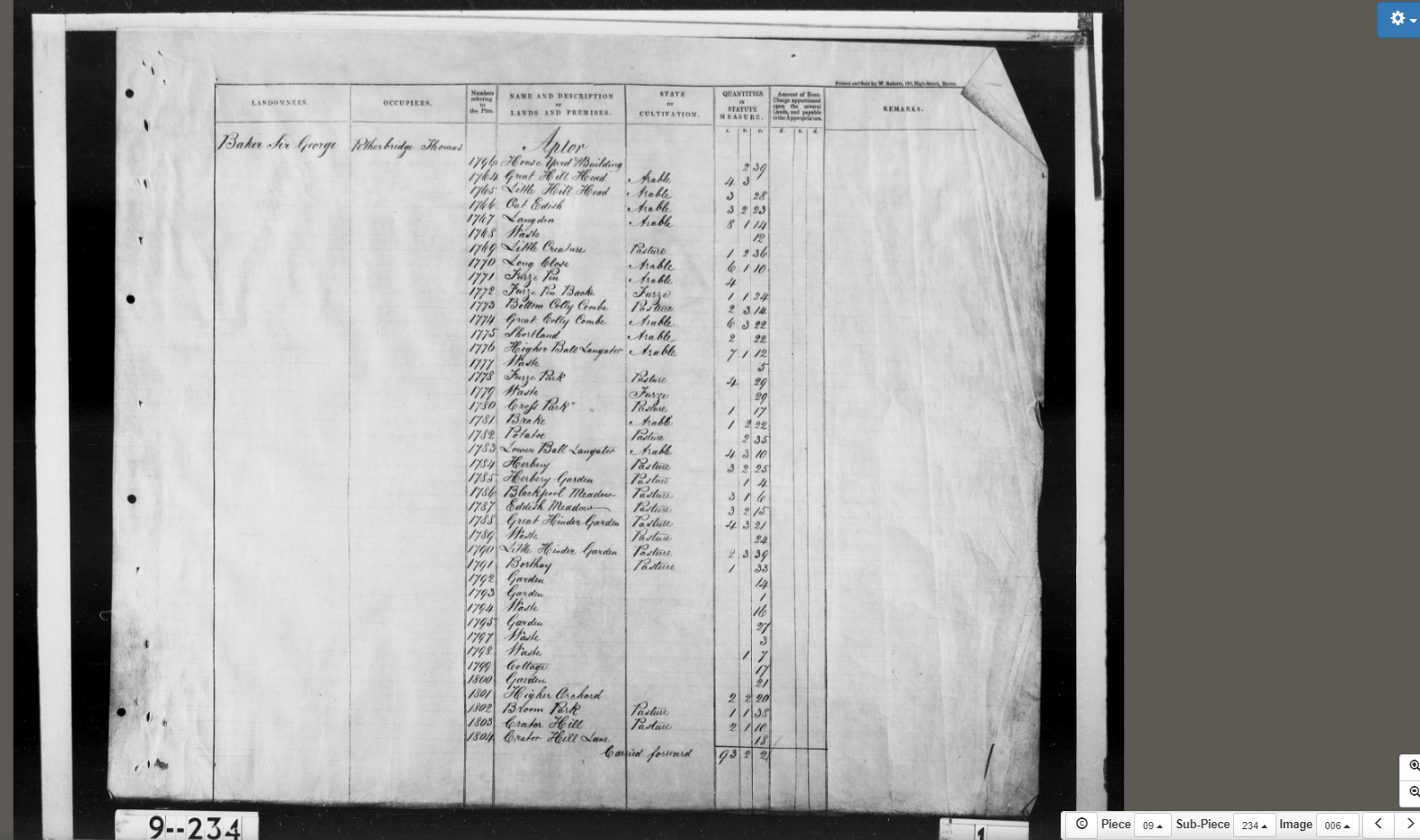
For each record found, you will have the option of viewing the transcript, the original apportionment image or an image of the map for that parish. When you click the map icon to view the apportionment map, the viewer will automatically jump to the plot for the specific record you clicked on. You can then use your mouse wheel or pinch to zoom out to see the whole map.
Original apportionment image accessed by clicking the second logo;
On the bottom right hand corner of the map page, you can browse further tithe maps by selecting piece and item numbers (the same as The National Archives Discovery reference) from the drop down boxes ‘piece’ and ‘sub-piece’. Where maps have altered apportionments there is also a drop down box (next to the piece and sub-piece boxes) to select the various additional maps.
If you just wanted to browse a map for a particular parish within the Tithe Records section as shown, you just need to select the required county from the list and then either type in the parish or select the parish from the scrolling menu.
If the parish is not listed in the Tithe Map collection, then it is most likely that the parish was enclosed prior to the 1836 Tithe Commutation Act and was therefore not included. One object of the Enclosure Acts was to remove the obligation to pay tithe, and between 1604 and 1914 over 5,200 individual Enclosure Acts were put into place.
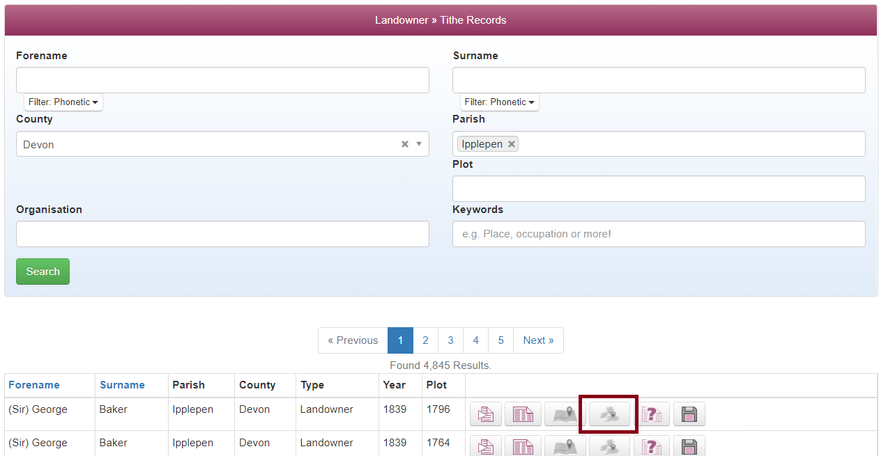
If we go back to the search page and then click search after typing in the parishes we will see all the plots of the map of Ipplepen, a lot on this occasion seem to list the landowner as Sir George Baker.
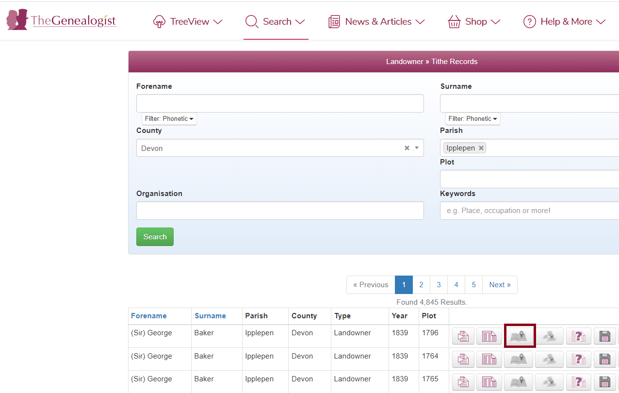
By clicking on the map you will then be taken to that specific plot on the Tithe map that you can then zoom out of to view the entire map for the parish, if you were perhaps looking for a particular house or plot of land you could then use modern day maps and landmarks/rivers/roads etc to try and navigate yourself around the Tithe map to discover the house or plot you are looking for without even knowing the name of the landowner or occupier. The plot will then give you a number that you can go back and type into the search page;
Our Map Explorer™ which can help researchers find an ancestor's property and watch the landscape change over time has now been enhanced by the addition of georeferenced black and white Tithe Maps. This is an ongoing project with new Counties being added frequently.