
News and Articles from 2021
Choose a year
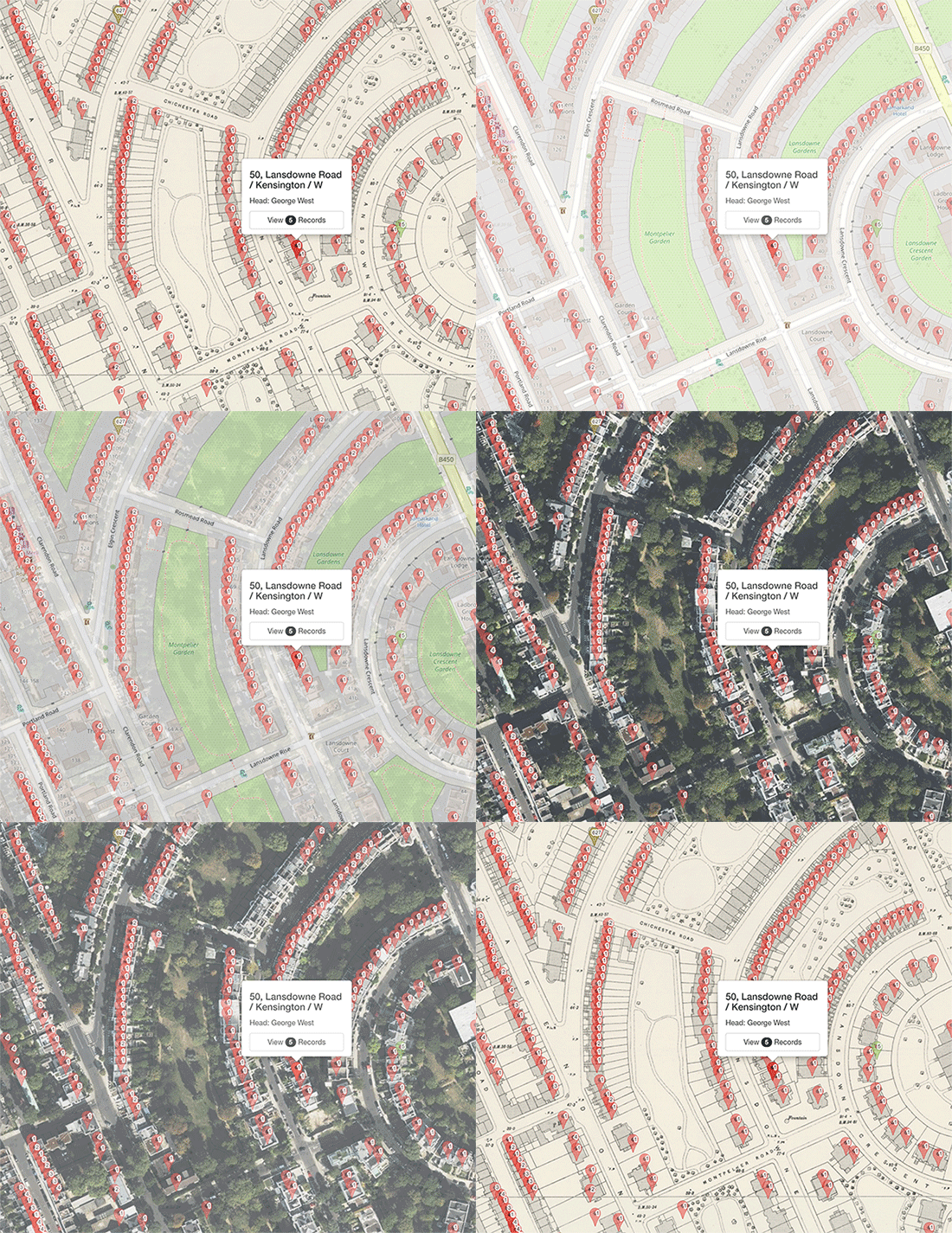
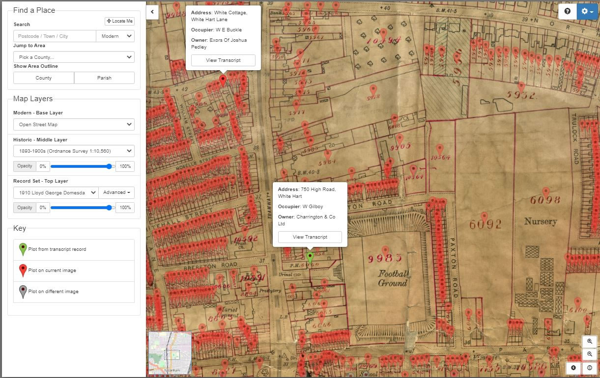
Pinpoint ancestors homes from the 1911 census on historic maps
24th December 2021
MAJOR NEW RELEASE
Travel back in time and locate an ancestor's address from the 1911 England and Wales census using contemporary and georeferenced maps on our Map Explorer™.
For the first time the properties recorded in the 1911 census can now be matched with mapping to show where our English or Welsh ancestors had lived at that time. The majority of London can be seen down to property level, while the rest of the country currently will identify down to parish, road or street with house level matching as new areas are processed.
This groundbreaking feature allows you to pin down your ancestors to properties on a contemporary map at the time of the census in 1911. With this feature family historians are able to walk the streets where their ancestors lived as not only can it be accessed on a computer but also on the move on a mobile phone!
This is an invaluable tool for house historians making it easier than ever to link census records to properties and complementing the already rich georeferenced Lloyd George Domesday Survey and Tithe records that are already available on Map Explorer™.
Watch our short video on the new release and see the records in action :
New Edmonton, Enfield and Southgate 1910 Property Records
10th December 2021
Our latest release sees 60,290 new owner and occupier records added to our unique Lloyd George Domesday Survey record set. The IR58 Inland Revenue Valuation Office records reveal to family historians all sorts of details about their ancestors' home, land, outbuildings and property owned or occupied in Edmonton, Enfield and Southgate at the time of the survey in the 1910s.
These property tax records, taken at a time when the government was seeking to raise funds for the introduction of social welfare programmes, introduced revolutionary taxes on the lands and incomes of Britain's population. To carry out this policy the government used surveyors to catalogue a description of each property in a street and also to plot its location on large-scale OS maps.
Using the IR58 records from The National Archives, these valuable records can now be searched using our Master Search or by clicking on the pins displayed on our powerful Map Explorer™. The ability to switch between georeferenced modern and historic maps means that the family historian can see how the landscape where their ancestors had lived or worked may have changed over time.
This online 1910s property records resource is unique to TheGenealogist and enables the researcher to thoroughly investigate a place in which an ancestor had lived in the 1910s notwithstanding that the streets may have undergone unrecognisable change in the intervening years.
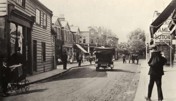
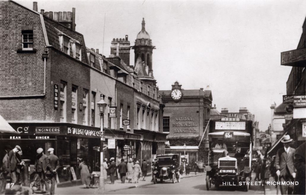
South West London Property Records
29th October 2021
Today's release includes records that let you discover the homes of England's most infamous monarch, English Rugby and the modern home of England's archives!
We have just released over 49,000 records into our unique Lloyd George Domesday Survey records, with the addition of owners and occupiers from the 1910s property tax records for Barnes, Hampton, Richmond upon Thames, Teddington and Twickenham.
These occupier and ownership records can be searched for using the Master Search at TheGenealogist or by clicking on the pins displayed on our powerful Map Explorer™. Only available online from TheGenealogist, these records enable the researcher to thoroughly investigate a place in which an ancestor lived, even if the streets have undergone massive changes in the intervening years.
You can find out more about these collections and discover the humble beginnings of The National Archives Kew in our latest featured article.
New Irish Records
15th October 2021
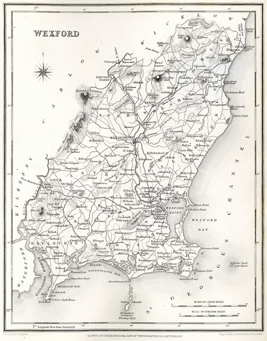
We have just released nearly 1 million records of baptisms, marriages and burials from Wexford Catholic Parish Records and new Dublin Will and Grant Books to provide a valuable resource for those researching Irish ancestry.
The Wexford Parish records have been newly transcribed and also benefit from our SmartSearch that enables subscribers to look for the parent's potential marriage records from baptism records and also potential siblings. Each result also has a link to view the registers on the National Library of Ireland's website should the researcher wish to see an image of the actual page of the Catholic parish register.
The Dublin wills are from the Deputy Keeper Of Ireland, Index To The Act or Grant Books, and To Original Wills, of The Diocese Of Dublin 1272 -1858 (26th, 30th, and 31st Report) and cover an area that is bigger than the current County of Dublin as the diocese included a sizeable part of County Wicklow, some substantial parts of southern and eastern County Kildare, as well as smaller portions of Counties Carlow, Laois (Queen's County) and Wexford.
You can find out more about these collections and discover George Harrison's Wexford ancestors Irish Parish Records in our latest featured article.
Over 1.4 Million Norfolk Parish Records Added
24th September 2021
This week we have considerably increased our Norfolk Parish Records coverage by releasing 1,445,523 new individuals into our growing Parish Record Collection. These records, which are released in association with the Norfolk Record Office, are fully searchable and transcribed while also being linked to high quality images making them an extremely valuable resource for researchers of this eastern part of England.
With over 12 million records for Norfolk alone, these Parish Records allow researchers to find their ancestor's baptisms, marriages and burials recorded by the parish church. Some registers will take the family historian back as far as the mid 16th century and up to much more recent times, as our latest feature article discovers when we discover Royals sandwiched on the Parish Register page between Carpenters and Production Operatives.

Announcing 1086 Domesday Book records on Map Explorer™
24th September 2021
MAJOR NEW RELEASE
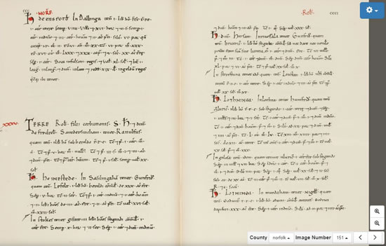
The fascinating Domesday Book from 1086 can now be searched as a layer on Map Explorer™ with pins on the maps, linked to transcripts and images of the pages, identifying each entry in this Norman survey.
Pins on the map indicate where a record exists in 1086 and links to records that show holdings before and after the conquest. Discover the name of the Overlord, Tenant in Chief and Lord of areas across England. Find out the numbers of villagers – and even slaves that were the lord's property – for places at the time of William the Conqueror's rule. Researchers can click the link to read the transcripts of the records that give details of the land, see who held it in 1066 and then in 1086, as well as see images of the actual pages from the 1086 Domesday Book.
Over 52,000 new records for Ealing Released
3rd September 2021
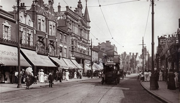
We have just released 52,429 records for the Borough of Ealing in the west of London for the period just prior to the First World War. This area consists of the seven major towns of Acton, Ealing, Greenford, Hanwell, Northolt, Perivale and Southall as well as the area of Hayes, Norwood and part of Hammersmith. It was once in the county of Middlesex and because it was halfway between city and country, with pleasant greenery, it was often referred to as the 'Queen of the Suburbs'.
The records can be quite revealing for family historians as they give details of houses and other buildings owned in the area by our ancestors at a time when the Government surveyed Ealing in the period between 1910-1915.
To make it easier to understand how areas may have changed over the years, we have also plotted each property onto large scale contemporary Ordnance Survey Maps which are available on our versatile Map Explorer™. This allows users to switch between modern and historical maps so that a researcher is able to see any changes that have taken place in the surrounding neighbourhood with the passing of time.
These land tax records, when used in conjunction with other records on TheGenealogist such as census, street directories etc can build a better picture of the environment in which your ancestors worked, lived or played.
To find out more about these records, read our Featured Article, "The Home of St Trinian's and The Lavender Hill Mob".
Over Half A Million New Tithe Plots Added
13th August 2021
Our Map Explorer™, the powerful mapping tool for family historians, has been boosted this week by the addition of four new counties of georeferenced Tithe Maps to the record set layer. This release adds another 784 maps, bringing the total number of Tithe Maps in Map Explorer™ to over 10,000. This means there are now over 4.5 million viewable records indicated by Map Pins on Map Explorer™.
You can now view the Victorian Tithe Maps linked to apportionment records for Cornwall, Derbyshire, Northamptonshire and Worcestershire which are overlaid on the modern and historical maps of the base and middle layers.
Tithe records allow researchers to find land that was owned or occupied by ancestors in the period 1837 to 1850s, with some additional altered apportionments in later years when property was sold or divided. This means that it was not just the wealthy landowners who were recorded in the tithe records but also those tenants who may have farmed a small plot or lived in a cottage.
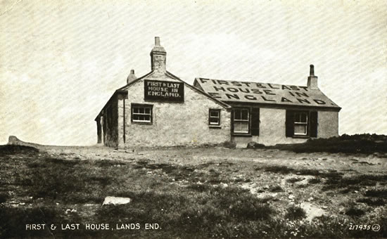
To find out more about this release, you can read our featured article "Keeping it in the Family - The Tale of Land's End".
New Suffolk Parish Records
30th July 2021
We have just added a further 322,894 individuals to our continually increasing collection of Parish Records with the release of a set from the English county of Suffolk.
These East Anglian church registers have been fully transcribed and linked to images of the actual pages from the books that were once kept by the Anglican Parish Churches. From before Victorian times and the introduction of Civil records, as the Established Church of the state, these important Church of England documents recorded the baptisms, marriages and burials of our Suffolk ancestors. In some cases, these important records will allow family historians to find their ancestors as far back as the 16th century.
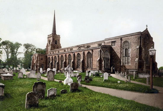
Parishes in this release include Ashby, Belton, Blundeston with Flixton, Bradwell, Burgh Castle, Carlton Colville, Corton, Fritton, Gisleham, Gorleston with Southtown, Gunton, Herringfleet, Hopton, Kessingland, Kirkley St Peter & St John, Kirkley St Matthew, Knettishall, Lound, Lowestoft Christchurch, Lowestoft St Andrew, Lowestoft St John, Lowestoft St Margaret, Mutford, Oulton Broad, Oulton St Michael (Oldton), Pakefield, Rushmere, and Somerleyton.
To find out more about this week's release, you can read our featured article "The Fishy Tale of the Lowestoft Witches".
Over 1 million 1910s Property Records Now Searchable!
16th July 2021
We have now added a total of over 1 million individuals to our unique Lloyd George Domesday Survey recordset with the addition this week of 85,959 individuals from the 1910s property tax records for the Borough of Haringey. Covering the areas of Hornsey Central, Hornsey East, Hornsey West, as well as Tottenham A, Tottenham B, Tottenham C and Wood Green, this week's release is made up of maps and field books that name property owners and occupiers in an exclusive online resource that gives family history researchers the ability to discover where an ancestor lived in the 1910-1915 period.
When combined with other records such as the 1911 Census, the IR58 Valuation Office records give researchers additional information about their ancestor's home, land, outbuildings and property. While these records may be searched from the Master Search or main search page of TheGenealogist, they have also been added to TheGenealogist's powerful Map Explorer™ so that the family historian can see how the landscape where their ancestor lived or worked changed as the years have passed..
To find out more, read our featured article about a modest house that gave its name to a famous football stadium.
New Thom's Official Directories
3rd July 2021
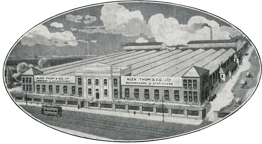
We have just released a collection of Thom's Official Directories covering the United Kingdom of Great Britain and Ireland from Victorian times up to the 20th century. These records are great for discovering more about the towns and areas, finding the names of people who held official municipal or government offices, or were professionals such as doctors, clergy, etc.
You can use these books to find Irish businesses from manufacturers of Ales and Agricultural implements to makers of Woolens and Yarns. Thom's directories allow you to find business advertisements as well as search for tradespeople from Auctioneers and Blacksmiths to Watchmakers and Wine & Spirit Dealers for all parts of Ireland.
To find out more, read our featured article about the founder of Thom's Directories, Alexander Thom – Publisher and The Queen's Printer for Ireland.
New Irish Parish Records
2nd July 2021
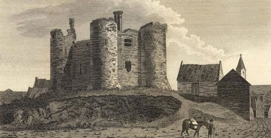
We have just added more than 327,300 individuals to our Irish Catholic Parish Record Collection. These new records have links to the original images and cover the County of Carlow in the southeast region of Ireland.
Before civil registration was introduced in two stages into Ireland, first in 1845 for non Roman Catholic marriages and then in 1864 for all births, marriages and deaths, the parish registers of the various denominations were the main records in which Irish ancestors' vital events would have been recorded. The Roman Catholic church was far the largest denomination in Ireland and so it is these records that the majority of Irish forebears will mostly appear within.This release of Irish records joins those of the Irish Wills recently made available and so expands the coverage of Irish records on our family history site which is renowned for our comprehensive search facilities.
New Scottish Census 1841-1901
19th June 2021
MAJOR NEW RELEASE
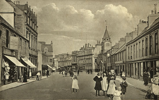
We are excited to announce the launch of the Scottish Census 1841-1901! For the first time you can use our renowned brick wall busting search tools on these Scottish records, so now it is easy to find a person using keywords such as occupation, birthplace, year of birth and more, search for a family using their forenames or search for an address.
We have been extremely busy in the last year expanding our coverage for our Diamond subscribers to cover all areas of the British Isles. This release comprises 24 million records, bringing us to over 75 million records released in the last 9 months!
Recent releases have seen 14.5 million individuals from all the Anglican Parish Records for Wales added. A further 34 million records for England and Wales came with the release of the 1939 Register records. There were 100,000 Irish Will records and now, this week, TheGenealogist is pleased to announce that these have been joined by over 24 million records from the Census of Scotland 1841-1901.
This is the first time that we have released such a large number of Scottish records and it now means that this important data for the most northerly part of the British Isles can now be searched using the comprehensive search features for which we are renowned. Appreciated by family historians researching their ancestors for the ease of use of our powerful Master Search, we give researchers the ability to select phonetic, exact or standard search filters.
The comprehensive search facilities that are already available when using our English and Welsh census records will make this Scottish census release a welcome addition to the family history researcher's toolkit.
This week's article sheds a light on Scottish census records where we find the builders of many of the lighthouses around the Scottish coast as well as the families that lived in them.
Jump back in time – Image Archive pictures now pinned to maps
28th May 2021
MAJOR NEW RELEASE
We have added a marvellous new feature to Map Explorer™ this week.
Already boasting georeferenced historical and modern maps, Tithe Records and Maps to look for your Victorian ancestors' homes, Lloyd George Domesday Records and Maps for nearly one million individuals, Headstones and War memorials, Map Explorer™ now also allows Diamond subscribers to see what their ancestors' towns and areas once looked like.
Watch our short video on the new release:
With the addition of these period photographs of street scenes and parish churches where researchers' ancestors may have been baptised, married and buried, this new feature allows subscribers to jump back in time.
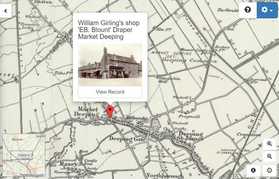
This release sees the ever-multiplying collection of historical photographs from TheGenealogist's Image Archive accessible for the first time from inside Map Explorer™ as a recordset layer. The various images for an area have their locations pinpointed on the maps allowing family historians to explore their ancestors' hometowns and other landmarks from around their area.
When viewing an Image Archive record in TheGenealogist's Map Explorer™, the family history researcher is shown the image's location on the map as well as from what point of view the photographer took the photo. Also included underneath the historical image is a modern map and street view (where it's available) so that the person researching their past family's area is able to compare the picture from the past with how the area looks today.
When used in conjunction with the other georeferenced maps and associated records, TheGenealogist's Map Explorer™ is a highly valuable tool for those researching their family history.
To find out more about this release, you can read Nik Thorne's article "See where your ancestors lived through their own eyes".
RAF Operations Record Books for the Dambusters squadron go online
14th May 2021
MAJOR NEW RELEASE
We are marking the anniversary of the famous Royal Air Force Dambusters raid on the Ruhr Valley dams in May 1943 by releasing over 1.55 million fully searchable records in the RAF Operations Record Books (ORBs), including those ORBs for the famous No 617 Squadron, giving an insight into their lives.
To find out more about these records, read Nick Thorne’s article: Guy Gibson and the dambuster raid found in RAF Record Books
Bringing the total to over 6.74 million records, these new diary-like RAF documents paint a picture of the goings-on in a squadron on a day-to-day basis for those units under British control.

TheGenealogist adds over 100,000 names to its Irish Will Indexes
30th April 2021
TheGenealogist’s Index of Irish Wills 1484-1858 is an index to surviving records of Wills, Grants and Administrations, held by The National Archives of Ireland (NAI). Records include the original NAI reference, which can be used to order a copy of the existing document.
This new release adds an easily searched and useful resource to the ever-growing suite of records available to Diamond subscribers of TheGenealogist. The Index of Irish Wills 1484-1858 features:
- More than 100,000 names
- Easily Searchable by Name, County, Address and Keyword
- Can provide dates, occupation, status and place of abode
- Can provide reference and link to order the document from the National Archives of Ireland.
Prior to 1858, Irish wills were administered by the ecclesiastical courts of the Established church, (the Church of Ireland), a part of the Anglican communion. In 1857, however, the Church of Ireland lost its responsibility for Irish Wills when the Probate Act of that year transferred the supervision to the state.
To find out more about these records, read Nick Thorne’s article: Using Irish Wills to discover your ancestors
New London Lloyd George Domesday Records
16th April 2021
We have released the records of 143,956 individuals to increase our Lloyd George Domesday Survey record set coverage. This unique online resource of nearly one million individual records, can help researchers discover where an ancestor lived in the period 1910-1915. The new records this month are for properties situated in Balham, Battersea, Fulham, Hammersmith, Putney & Roehampton, Streatham, Tooting Graveney and Wandsworth.
This fascinating combination of maps and residential data from The National Archives enables researchers to precisely pinpoint an ancestor's house on the large scale and exceptionally detailed hand annotated maps from the period. Fully searchable and linked to the versatile Map Explorer™, Diamond subscribers can see how an area has changed over time by switching between various georeferenced modern and historical map layers.
Complementing the maps are the accompanying Field Books that will also provide researchers with detailed information relative to the valuation of each property, including the valuation assessment number, map reference, owner, occupier, situation, description and extent.
To find out more about these records, you can read our featured article, "Finding the Wandsworth homes attacked in the WW1 'Lusitania' Riots".
New Release: The 1939 Register with SmartSearch
1st April 2021
MAJOR NEW RELEASE
We have released the 1939 Register transcript, adding our unique and powerful search tools and SmartSearch technology. This offers a hugely flexible way to look for your ancestors at the start of the Second World War.
Our well known brick wall shattering search tools include the ability to find your ancestor in 1939 by using keywords, such as the individual's occupation or their date of birth. You can also search for an address and then jump straight to the household. If you're struggling to find a family, you can even search using as many of their forenames as you know.
Once you've found a record in the 1939 Register, you can click on the street name to view all the residents on the street, potentially finding relatives living nearby.
Take your research journey quickly forwards by using our innovative SmartSearch to jump to a person's birth, marriage or death record.
The 1939 Register can often reveal important additional information about your ancestors that will help build your family's story. The powerful keyword search can find evacuees by searching for their name and date of birth along with the keyword "evacuee". The fact individuals are listed with their full dates of birth is a huge benefit that the 1939 Register has over the census, which simply lists the age of a person.
We make searching the 1939 Register more flexible. Search by:
- Name (Including wildcards, e.g. Win* Church*)
- Address (e.g. Whitehall)
- Keywords (e.g. Admiralty)
- First names from a family group (e.g. Winston, Clementine)
To find out more about this record set, read our article: A Window on September 1939 and George Formby the entertainer .
New Tithe Maps added to Map Explorer™
19th March 2021
We have added over 2,700 more parishes of Tithe Maps to Map Explorer™, which means over 30 counties of georeferenced Tithe Maps have been added to date!
TheGenealogist's Map Explorer™, the resource for researchers to turn to when searching for an ancestor's landholding whether owned or simply occupied, has been boosted with the significant addition of georeferenced Tithe Maps for Anglesey, Durham, Devon, Shropshire, Somerset, Suffolk and Wiltshire.
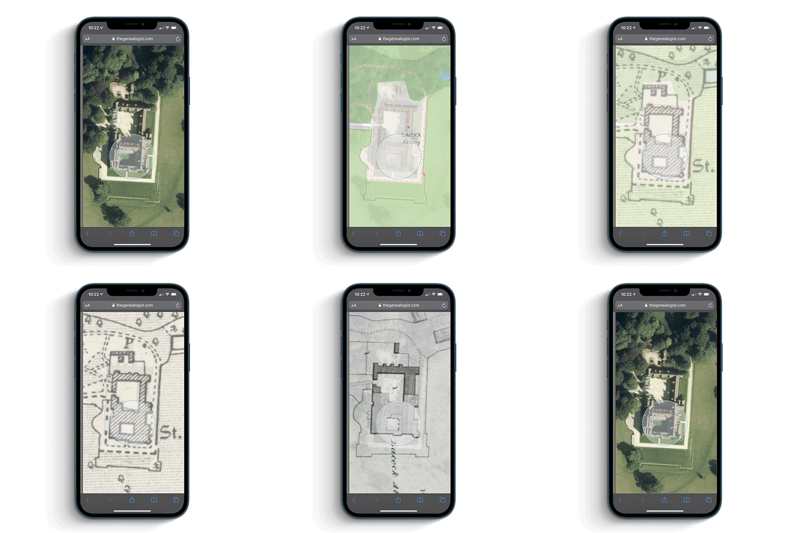
From cottages with gardens to acres of farmed land and country estates, the addition of georeferenced Tithe maps as a layer over modern and other historical maps will allow researchers to see how the landscape changed over time. Map Explorer™ gives the researcher the ability to switch between layers of tithe, historical and modern maps which are all tied to coordinates, allowing the user to see how places change over the years.
From a plot identified on the tithe map it is possible to click through to then see the description as it was recorded in the apportionment record at the time, thus revealing more about what an ancestor's holding had been. Using Map Explorer™ the family historian can browse an ancestor's area to find other plots that they owned or occupied. Alternatively, our Master Search can be used to look for ancestors' plots across the tithe records and then view them on Map Explorer™.
To find out more about these maps and MapExplorer™, you can read Nick Thorne's article "Travelling back in time with MapExplorer™ in your hand".
New Military Book Records
5th March 2021
We have released over 150,000 individuals to our ever expanding Military Record Collection. Containing names, places and dates, these publications can help the family history researcher find their ancestors and build a fascinating story of their lives. With records from Britain, Canada and a number of Indian registers and directories, these searchable records contain lists of men and women who served their country in various capacities connected to the military, and not just on the front line.
The records can be used to discover more about an ancestor's achievements and are fantastic for identifying where next to apply your research. These books can give dates of postings along with ranks or positions held in establishments, as well as a great deal more useful information that may help to build a better family history.
Use these records to:
- Add dates and details to the lives of your ancestors
- Discover where they served
- Fill in gaps in the information that you already have on an ancestor
- Find hints and 'signposts' to other records and places to search for forebears.
These records will often allow us to recount a much more rounded picture of the life of a person and so enrich the telling of their story.
To find out more about these records, read Nick Thorne's article "Finding a high-flying officer from both World War I and II."
![[ Sir Hugh Dowding, as featured in the records ]](/images/featured-articles/2021/01381/2021-03-dowding10.jpg)
New Map Records for Southwark and surrounding areas
12th February 2021
We have just released the records for another 98,618 individuals from Southwark to increase the number of records to over 800,000 individuals in our unique online Lloyd George Domesday Survey. These property records are a fantastic resource for researchers searching for where an ancestor lived in the period 1910-1915.
The Lloyd George Domesday Survey is a massive project to digitise a combination of large scale Ordnance Survey maps and residential data field books from The National Archives. Using the records from the former Valuation Office Survey (known as the Lloyd George Domesday Survey) enables family history researchers to precisely pinpoint where an ancestor's house had been on exceptionally detailed hand annotated maps from the period. These have been made even more useful to researchers as they have been georeferenced and are displayed as a layer in our powerful Map Explorer™.
Family historians can often have problems when looking for where their ancestors lived. Even when they have located an ancestor's address in the census, over time road names may have changed and many streets have been renumbered or bombed out of existence in the Blitz. With redevelopment the area can change substantially, adopting new layouts that make searching for where an ancestor lived using modern maps a frustrating experience.
Use these records to:
- link individual properties to pins on extremely detailed ordnance survey maps from the 1910s
- read information often giving a detailed description of the property in original Field Books
- locate a specific house on the map from an address found in a census or street directory
- search the records by surname, parish and street.
- zoom down to show plots of the individual properties as they existed in 1910-1915
- reveal modern map layers georeferenced to the survey maps to show the modern topography
The linked Field Books will also provide researchers with information regarding the valuation of each property, including the valuation assessment number, map reference, owner, occupier, situation, description and extent.
To find out more about these records, read Nick Thorne's article "Property records from the 1910s show us the Southwark of Michael Caine's family."
![[Nelson Dockyard, Rotherhithe from Lloyd George Domesday Survey maps]](/emails/2021/images/2021-02_lgd.jpg)
New Who's Who Records
29th January 2021
We have added new Who's Who records into our expanding Occupational Records, adding almost 100,000 additional individuals. This release includes records covering individuals from all over England, Scotland, Ireland, Canada, USA, New Zealand and further afield.
The records can be used to discover more about an ancestor's achievements and are fantastic for identifying where next to apply your research. Who's Who records will confirm birth dates and sometimes the place of birth. Often they give a father's name and occupation and a great deal more useful information that may help to build a better family history.
Use these records to:
- Add details to the lives of your ancestors
- Discover their accomplishments
- Fill in gaps in the information that you already have on an ancestor
- Find other records and places to search for forebears
These records will often allow us to recount a much more rounded picture of the life of a person and so enrich the telling of their story. This latest release expands our extensive Occupational records collection that includes actors, apprentices, clergy, crew lists, directors, flight, freemen, law, railway, sports, teachers and biographies as well as a number of other Who's Who books.
To find out more about these records, read Nick Thorne's article "Who, What, Where, When? - Discovering Who's Who"
New Headstones Release
8th January 2021
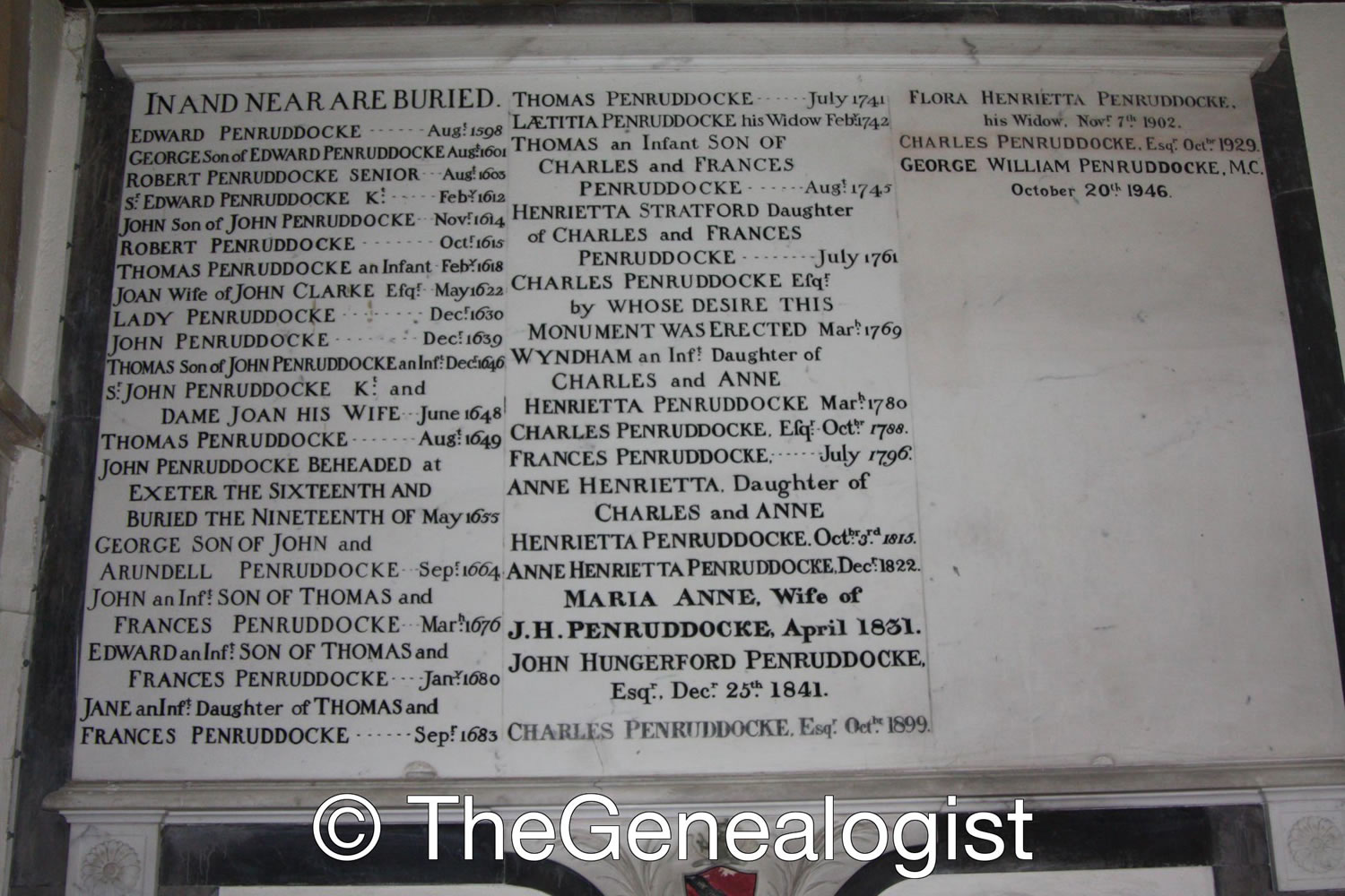
This release expands our Headstone Collection with over 55,000 new records. These are great for finding ancestors' names, dates and other details.
The fully searchable records with images allow family history researchers to find the inscriptions recorded on their ancestors' graves.
What’s Coming This Year?
1st January 2021
In 2021 TheGenealogist plans to release millions of new records to its subscription which aims to increase its coverage of a broad variety of records that are essential resources for family history researchers.
TheGenealogist’s MapExplorer™ will have additional Datasets and Features added including georeferenced image archive photographs. A range of new data layers will also be released allowing you to go to your ancestors parish, street and even their house.
Also, in partnership with The National Archives we will continue to add detailed maps down to street level into the MapExplorer™ as part of the Lloyd George Domesday Survey records.
TheGenealogist will be releasing key records covering Northern Ireland, Scotland, Wales and England.
Other new releases will include:
- Additional Parish Records with images
- Catholic Records
- Extra Naturalisation Records
- Change of Names Records
- Criminal Records
- Army, Navy and Royal Air Force Operations Records
- A Large New Newspaper Collection!
- And much more!
Keep an eye on this page as we release new rescords throught the year, here's to a great 2021!
Choose a year
Featured Articles
Visit our featured article section for fascinating stories and the latest news from the world of genealogy.
Latest Articles
The Strange Case of Jekyll (and Hyde) the Garden Expert
24th April 2024
We reveal where a garden designer put down her roots using this important Surrey land tax release.

More than just an address
11th April 2024
Looking up our forebears in the Street and Trade Directories

A long way from Tipperary
15th March 2024
Australian outlaw’s father discovered in the Irish Parish Records
Next Event
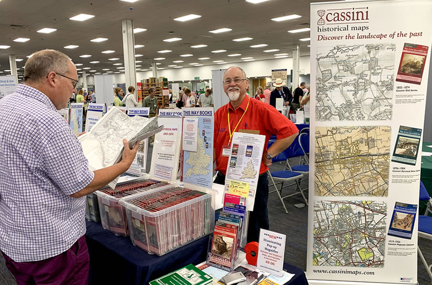
The Family History Show, York!
Saturday 22nd June 2024
10:00 –16:00 (GMT)
Put your research questions to an expert, watch a talk, speak to a local society, archive or genealogical supplier.
- Free talks all day, held in a large lecture hall.
- Free Experts on hand to help with your queries.
- Many family history societies, archives and companies will be attending from all over the country.
Special Offer! Buy tickets for £8.00 (£12.00 on the day)
Buy your tickets early and get two for the price of one!
Find Out More Purchase Tickets
Future Events
Unable to make the next show? We also have shows planned for the following locations:
Press Releases
Visit the press releases section for the official write-up of all our news.
